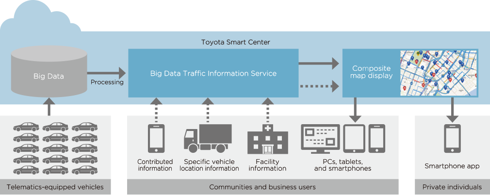
Big Data
Big data traffc information service
This service provides traffic information generated from big data that includes vehicle location/speed and driving conditions, gathered and collected through our telematics service. The VICS (vehicle information and communication system) that is commonly used can identify traffic congestion on all roads in Japan, but this big data traffic information service can determine traffic conditions in real time on trunk roads and at the city street level, not just on major roads. This Big Data Traffic Information Service can also serve as a platform to be used by various companies and municipal agencies. The companies and government agencies that use this service can add their data to maps to improve traffic flow, provide map information, and improve disaster management.
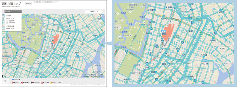
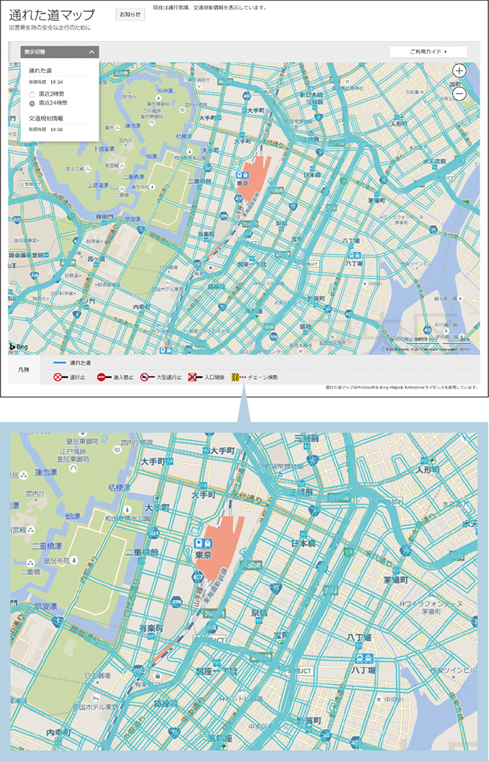
Passable route maps
Route history information for the most recent 24 hours is shown on a map, based on probe data collected from Toyota vehicles (vehicles equipped with T-Connect, G-BOOK, and G-Link). Because route history information is constantly updated, the most recent three hours of information can be viewed on a computer or smartphone. It can display routes to shelters during disasters and assist with navigation. Municipal agencies can also use it to provide evacuation and disaster information through traffic information services. Passable route maps